Donovan-Wildcat Conservation Area

Norwell

Moderate Parking available Scenic views

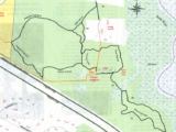
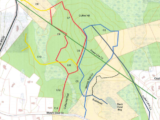
The Donovan-Wildcat Conservation Area is rich with history. The conservation area is a 50-acre site that was part of a 1997 land acquisition by the town of Norwell. The conservation land consists of fields and some wooded areas as well. The Donovan fields were originally known as "White Oak Plans" and was part of a large Colonial land grant to the Clap family. It was cleared for farming in 1820. A horse track was also established where Centennial Way is now located. By 1955, there was a thriving and successful apple orchard which is now long gone. The only evidence of this orchard is a low brick building that was used for storage and packing. The construction of the trail was part of a development agreement in 1997. As the trail progresses, it transitions to the Wildcat Hill area. This was an area that was originally settled by freed slaves from the Clap family. There are incredible stone walls that criss-cross through the forest. TRAILS There are two main entrances to the trail with parking access. Additionally, the trail can be divided into two sections: field and woods. FIELD - If you access via Pleasant St, the trail travels along the west side of the field to an old pond area with the remains of a stone dam. You can walk around the field the the Norwell Walkway. This trail is more level and stroller accessible. WOODS - Just under 2 miles of trails in the woods. Terrain is very uneven and rocky. Not as well maintained but largely the paths are clear. Depending on the time of year, it might be easier to see the trail markers.

More Info

Town Norwell
Size 150 acres
Cost Free
Stroller rating C
ADA access No

Parking

Limited on-site lot on Circuit St near the Pleasant St intersection; additional parking off Wildcat Lane

Facilities

Informational kiosk and picnic table at main parking area; benches at some trail intersections; several benches along Margaret's Brook; geocache locations

← Back to all trails