Hingham

Bare Cove Park

Hingham Parking

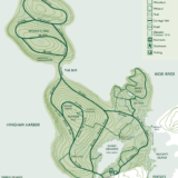
Bare Cove Park consists of 484 acres along the Weymouth Back River in Hingham. The park is a hidden gem for South Shore residents. The park has been designated as a wildlife sanctuary and offers diverse habits for plant and animal life. Park signage helps to educate users about the variety of owls, deer, and other wild animals that share the space. The variety of trails can make every visit to Bare Cove Park different from the prior one. The combination of paved and dirt trails make it perfect for just about everyone. You'll see other guests enjoying jogging, hiking, biking... or just out with the family dog and stroller. In 2017, changes were made to allow some off-leash dog areas. There is a special map and signage to help designate which areas are appropriate for off-leash play. A permit is also required and more information can be obtained on the Hingham town website. A separate website has been maintained to campaign for this off-leash privilege and is a great resource for understanding the guidelines. HISTORY Prior to 1906, the land was privately owned. Due to its convenient access by water to Boston Harbor, the site was acquired by the U.S. Navy and used as an ammunition depot until 1971. In 1972, the Government declared the depot surplus and divided it up for several uses, including Bare Cove Park, South Shore Model Train Club, and Bare Cove Fire Museum. ( Source ) TRAILS There are 5 miles of paved trails that loop through the park. Additionally, there are countless other wooded trails that offer a more traditional trail experience. Trails are incredibly well-labeled throughout the park with additional signage and informational kiosks to educate the public.

Bare Cove Park

Bathing Beach

Hingham

Bathing Beach is a lively multi-purpose park on Hingham Harbor, with a swimming beach staffed by seasonal lifeguards, restrooms, and concessions, plus lawns, shade trees, and a quarter-mile walking trail. It is a genuinely pleasant spot to spend an afternoon, whether you are there for the water or just the view.

Bouve Conservation Area

Moderate Hingham Parking

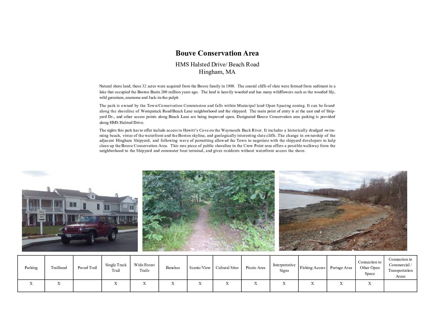
Bouve Conservation is a 32 acre preserve located along Hewitts Cove in Hingham. The area was acquired from the Bouve family in 1980. Currently the park is owned and managed by the Hingham Conservation Commission. It is a wonderful site that provides unique shoreline views. According to Hingham’s

Bouve Conservation Area

Brewer Reservation

Moderate Hingham Parking

Brewer Reservation in Hingham links directly to Cassidy Field and Ridgewood Reservation, and combined with More-Brewer Park just across the street, the two properties add up to nearly 5 miles of trails through piney woodlands on unpaved roads. It is a good option if you want a longer, quieter walk without much elevation change.

Burns Memorial Park

Easy Hingham Parking

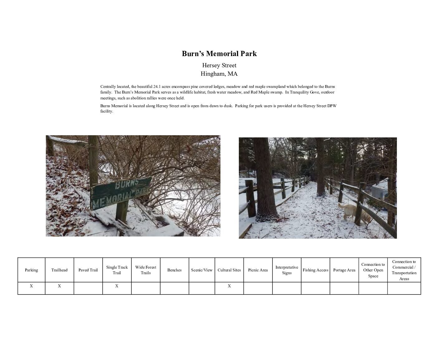
[pdf-embedder url="https://southshoretrails.com/wp-content/uploads/2017/11/Burns-Memorial.pdf" title="Burns Memorial"]

Burns Memorial Park

Cranberry Pond – Hingham

Easy Hingham Parking

Hingham's Cranberry Pond was once part of a working cranberry bog system, and today this small pond on French Street offers scenic water views along with 0.4 miles of woodland trails, plus seasonal ice skating when conditions allow.

Crooked Meadow River Area

Moderate Hingham Parking

Crooked Meadow River Area is a small-but-mighty 0.6-acre conservation property in Hingham. The well-maintained Serenity Path leads past glacial erratic boulders and rocky outcroppings, offering distant views of Crooked Meadow River -- a short, contemplative walk rather than a long hike, but a pleasant one.

Eel River Woods

Moderate Hingham Parking

Eel River Woods is a 12 acre conservation parcel located along Cushing Street in Hingham. The land is maintained by the Hingham Land Trust along with several other parcels in town, including Jacobs Meadow and Whortleberry Hollow. The land was donated by Mary Niles. The Niles family have previously donated 4 additional acres along Cushing Pond. The Eel River Woods trail is probably something that you've driven by a million times. The Hingham Land Trust sign peeks out from the woods and just barely catches your attention - but it is worth a stop. Although the trail system totals less than a mile, it feels like a bit more due to the number of loops, hills, and benches that are included. The benches are thoughtfully placed under the protection of tall tree canopies. While the Fall is beautiful in New England, we think this trail probably shines the most in early Spring on account of some of the plant life and wild flowers. This is a pretty short trail so if you are looking for a little more adventure, you can very easily visit another trail in the nearby vicinity. Give yourself a warmup at Eel River Woods and then check out our trail map for other great options in the area! TRAILS Less than about a mile - but perhaps feels like more as a result of the loops. Trails are relatively well maintained but not accessible to strollers or people unsteady on their feet. There are some portions that are very solid, but not consistently enough for a visit.

Eel River Woods

Fee Pond

Easy Hingham Parking

The 2.5-acre Fee Pond, in the Crow Point neighborhood of Hingham, offers a quiet spot for nature study and seasonal ice skating, with walking trails on two sides totaling about 0.2 miles. According to Hingham's own "Parklands for the Public" map, this pond was actually used as a source of ice back when Crow Point was a summer resort -- look for the "Fee Street" sign on Grove Avenue, which is really more of a path than a street.

Foundry Pond

Easy Hingham Parking

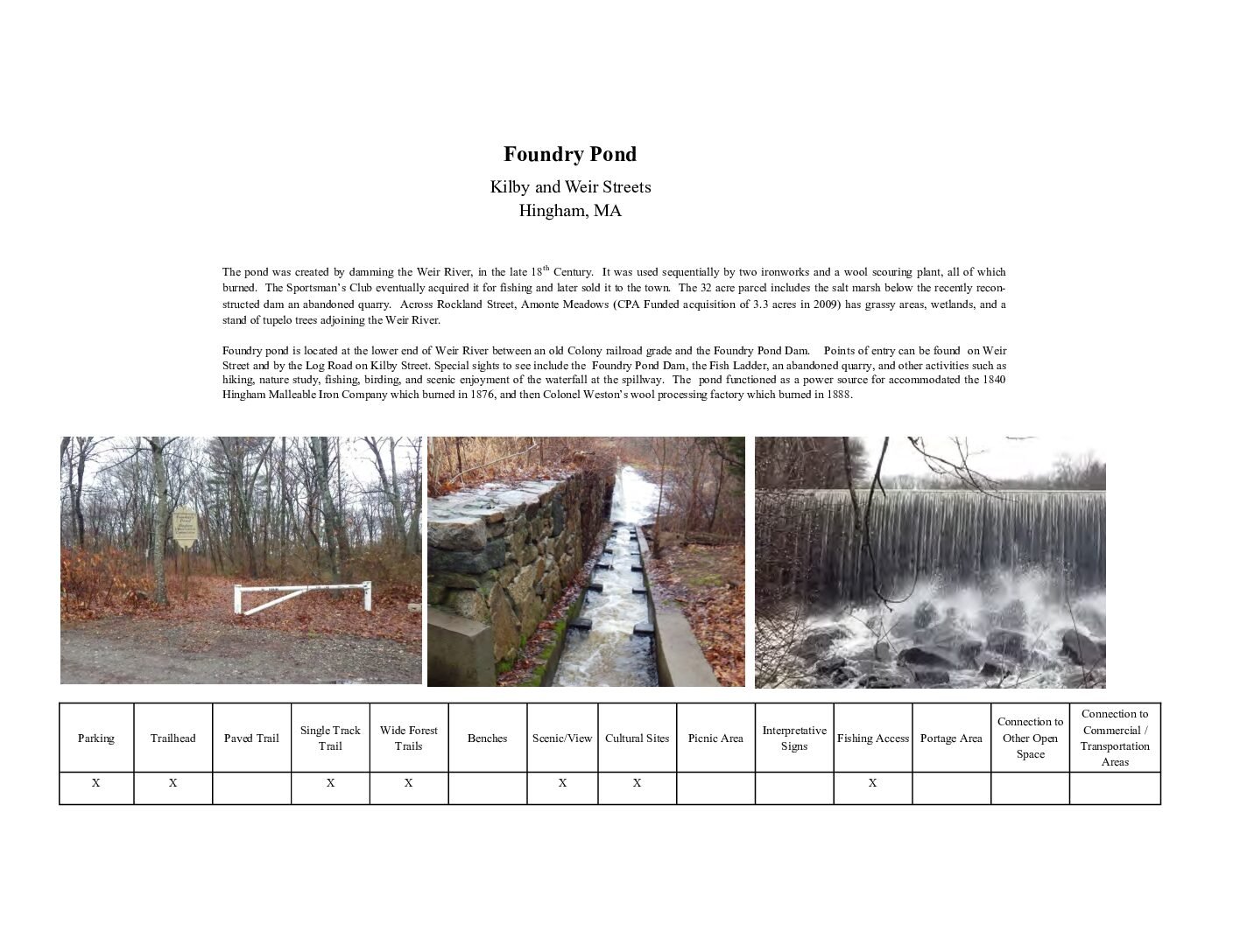
[pdf-embedder url="https://southshoretrails.com/wp-content/uploads/2017/11/Foundry-Pond.pdf" title="Foundry Pond"]

Foundry Pond

George Washington Forest

Moderate Hingham Parking

George Washington Forest, also known as the Hingham Town Forest, offers 197.6 acres of wooden open space featuring conifer groves, winding eskers, and fern carpeted swales not found elsewhere in Hingham. The trails are actually carriage paths wide enough for forest maintenance but are excellent for walking. The forest uplands are mainly composed mainly of Red and White Pines and Norway Spruces. Wetland depressions are full of maple shrubbery. The forest is east of Fulling Mill Pond, and glacial ridges and hills surround the area. Many people come to the forest to birdwatch, jog, and horseback ride. A small pull off parking area is available along South Pleasant Street. The George Washington Town Forest was diagnosed with “Red Pine Scale” and the “Pine Shoot Beatle” which has contributed to the wide- spread mortality of the Red Pine Trees in the forest. After extensive research and plant diagnostic site work performed by the University of Massachusetts Extension’s diagnostic team it was determined that all trees that could potentially fall onto the roads or trails should be removed for Public Safety. About 80% of the trees that were a threat to the public have been removed and an on-going tree removal program is in place which evaluates and removes any threats to the public. (source: Hingham Conservation Commission Town Map) Why visit? Nice, wide paths that make it easy to walk with a friend or your dog. Very popular with dog owners but still serene enough to provide peaceful moment. TRAILS Approximately 3 miles of trails through the forest. Trails are not completely flat but kept wide and clear of brush or big rocks. The wide paths are used for forest maintenance. The map helps delineate which trails are wide and which ones are perhaps more narrow and less-maintained.

George Washington Forest

Governor Long Bird Sanctuary

Hingham

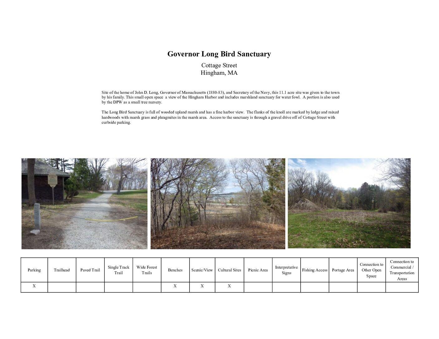
[pdf-embedder url="https://southshoretrails.com/wp-content/uploads/2017/11/Gov-Long-Bird-Sanctuary.pdf" title="Gov Long Bird Sanctuary"]

Governor Long Bird Sanctuary

Hingham Harbor

Hingham

Hingham Harbor is a popular put-in spot for kayakers and paddlers exploring Hingham Bay, with easy access from the town landing and views out toward the harbor islands. It is a reliable option if you are looking for a straightforward, no-fuss place to launch a boat on the South Shore.

Hingham Middle School Trails

Easy Hingham Parking

[pdf-embedder url="https://southshoretrails.com/wp-content/uploads/2017/11/Junior-High.pdf" title="Junior High"]

Lehner Conservation Area + Jacobs Meadow

Moderate Hingham Parking

Jacobs Meadow consists of 50 acres of open fields and varied woodlands from Main Street to the Fulling Mill Brook, with trail access on weekends and after school behind the Wilder Memorial Building. The trail presents a serene opportunity that is very family friendly! The wide open fields are perfect for getting some fresh air. Each of the connecting fields within Jacobs Meadow takes visitors further away from the hustle and bustle of Rt 228 in Hingham. Helen Burns, a major donor to the town, gave 30 acres to the HLCT and 8 acres to the HCC. The northern 10 acres were purchased by the Commission from abutters an the access to Main Street was donated by the Goodlatte family along with an easement given by Wilder Memorial. Two lots extending the park’s southeast corner have been given by Richard and Virginia Kurtzman (3.6 acres) and Robert and Carolyn Garvie (6.75 acres). (source: Hingham Conservation Commission)

Marchesiani Farmlands

Easy Hingham Parking

Marchesiani Farmlands in Hingham features just over half a mile of trails through 25 acres of historic farmland and woods, with up-close views of Accord Brook. The land was part of Pushcart Farm, purchased by the Marchesiani family in 1934, and once grew more than 10,000 tomato plants along with cucumbers, strawberries, and other vegetables. The mown field near the entrance still recalls that agricultural history, and the trail connects directly across Scotland Street into the adjacent McKenna Marsh Conservation Area, where there is another mile or so to explore.

McKenna Marsh Conservation Area

Easy Hingham Parking

McKenna Marsh is a 100+ acre open space in Hingham along Rt. 228. The land is rich with history and natural resources. Access to McKenna Marsh is provided through Marchesiani Farmland, a large field located along Main Street. This historic farmland was once a part of Pushcart Farm originally purchased by the Marchesiani family in 1934. Upon arrival, visitors will immediately notice the large field that leads hikers from the main road deeper into the woods. The preserve has several water elements including a freshwater marsh once used as a waterfowl preserve, with a beaver dam of unusual length. Additionally, Accord Brook weaves through the area, highlighting its importance for Hingham and Norwell town water supplies. The Hingham Conservation Commission has described the land as having "considerable high ground and open woods provide easy walking and vantage points to observe waterfowl. Large white cedars can be seen from the trail that skirts eskers toward the northern margin." (source: Hingham Conservation Commission) How to visit McKenna Marsh: Parking for McKenna Marsh is provided at the Main Street Middle School proximate to the tennis courts. Park users can follow the sidewalk from the parking area to Main Street and across Main Street via an existing crosswalk to access Marchesiani Farmland. The Farmland, a 25 acre field was acquired by the Town in 2001. The entrance to Marchesiani Farmland is marked by a stone wall and two granite monuments. The McKenna Marsh trail system connects to the Jacob’s Pond Conservation Land trails in Norwell, MA. [pdf-embedder url="https://southshoretrails.com/wp-content/uploads/2017/11/McKenna-Marsh.pdf" title="McKenna Marsh"]

Mildred Cushing Woods

Moderate Hingham Parking

[pdf-embedder url="https://southshoretrails.com/wp-content/uploads/2017/11/Mildred.pdf"]

More-Brewer Park

Moderate Hingham Parking

More-Brewer Park is located off Hobart Street in the West Hingham area of the South Shore. The park is slightly obscured from the main streets which keeps it from being a very active trail system. During a recent visit, there was only one other car - but it is also clear that there are loyal visitors. The Park is reminiscent of the Worlds End experience on account of the original owner growing up on his father's farm near Worlds End. The park totals 186.5 acres of varied land, much of it interlaced with winding carriage paths. An outstanding feature is a spacious meadow, surrounded by pine. Larch and dogwood. Brewer Pond, gorgeous when water lilies are in bloom, and the more secluded Ice House Pond, provided habitat for many creatures. Other features include a trail through Bear Swamp and the foundation of the tiny cottage of Bootleg Charlie, immortalized in Brookes More’s poetry. (source: Hingham Conservation Commission description) TRAILS About 5 miles! Most of which are wider cart paths and with level surfaces. Some trails are obstructed by fallen trees. Most of which are easy to get past, but not for those traveling with strollers or people with limited mobility. HISTORY Francis Brewer purchased the sheep grazing land at Great Hill in 1884. He had originally planned to create a park and transfer it to the town. Instead, he got married, built a house and farm, and raised a family. In 1921, the property was purchased by a poet, Brookes More. More's daughter married Francis Brewer's son, Wilmon. Nearly 100 years after Francis's intention of a public park, the More-Brewer Park was created in 1980 with a generous land gift from by the Brewer family. Over several years, the land gifts continued to the current state of 150+ areas from the Brewer family. In 2006, the addition of Bear Swamp was created by the gift of Gertrude Higgins. (source: Hingham Conservation Commission description)

More-Brewer Park

Old Swamp River Trail

Easy Hingham Parking

The Old Swamp River Trail is a small, tucked-away property in a remote section of Hingham, near the industrial parks close to the Rockland and Weymouth borders. It is a short one -- just 0.18 miles -- ending at an unnamed tributary to the Old Swamp River, which eventually feeds into Whitman's Pond and, further downstream, the Weymouth Back River.

Plymouth River Complex

Moderate Hingham Parking

[pdf-embedder url="https://southshoretrails.com/wp-content/uploads/2017/11/Plymouth-River.pdf" title="Plymouth River"]

Plymouth River Complex

Recreation Park Drive Trail

Moderate Hingham Parking

Hingham's Recreation Park Drive Trail is named for the street it sits on -- a short 0.42-mile loop through hardwood forest that connects Deerfield Road and Recreation Park Drive. There are several vernal pools here, plus a scrub-shrub wetland, all draining eventually into the Weir River watershed, and the trail is quick enough to fit into a lunch break if you are nearby.

South Elementary School Nature Trail

Easy Hingham Parking

[pdf-embedder url="https://southshoretrails.com/wp-content/uploads/2017/11/South-Elementary.pdf" title="South Elementary"]

Stodder’s Neck

Hingham

Stodder's Neck is a conservation parcel in Hingham along the Harbor. The conservation area is owned and maintained by the Department of Conservation and Recreation. Stodder's Neck was previously a gravel pit that was transformed in a park reminiscent of World's End. The paths and hilltop viewpoint are very similar to the structure of Frederick Law Olmsted's design for World's End. This park is most popular with dog owners. It would be nearly impossible to visit without seeing several dog owners enjoying the wide paths and lush landscape. In prior years, the landscape was very overrun by dog waste but you would never know it now. The park is very well maintained and clean. The paths are also stroller friendly and very level. Stodder's Neck is a must visit for your next pass through Hingham on errands. We think it goes great with your next errand trip to Trader Joe's, Hingham Shipyard, or Lowe's in Weymouth.

Stodder’s Neck

Sydney Ice Pond

Hingham Parking

The 5.1-acre Sydney's Pond property on Rockland Street in Hingham offers a short 0.17-mile walk through the woods with pond and wetland views, plus ice skating in the winter -- fitting, since this was once the site of an ice-harvesting business. Just up the road on Glacier Lane, don't miss the Glacial Boulder, a genuinely impressive rock deposited here by a glacier thousands of years ago, complete with a historic plaque honoring the former property owners who donated it to the town on the condition it be preserved forever.

Triphammer Pond Conservation Area

Moderate Hingham Parking

Triphammer Pond Conservation Area consists of 98 acres and was acquired by Hingham in 1945. Although not well documented on maps, Triphammer is connected to the Wompatuck State Park trail network. The 19 acre pond provides for a wonderfully quiet moment exploring the historic mill and looking for wildlife. The Triphammer Pond trails provide access to many recreational activities. The trails enable visitors to hike along narrow wooded trails and enjoy views of the pond or fish. Kayaking and canoeing are also permitted. In the winter months, ice skating is also permitted however visitors should be careful to test the ice. A reconstructed old mill dam, fish ladder, spillway, sluiceway, a stone well and remnants of other historic mill features are also found at this location. Access to Triphammer Pond is best obtained off of Popes Lane. A long dirt road provides access to an undeveloped parking lot and a portage area. It is relatively easy to put in kayaks to further explore the pond. TRAILS About a mile - but perhaps feels like more since you can wander a bit around the old Mill area Trails are relatively well maintained but not consistently accessible to strollers or people unsteady on their feet. People will limited mobility or strollers can easily walk from the parking area up to the dam and perhaps a little bit further.

Triphammer Pond Conservation Area

Turkey Hill

Moderate Hingham Parking

Turkey Hill is a 62 acre piece of land that is managed by the Trustees of the Reservation in partnership with the Towns of Cohasset and Hingham. Turkey Hill abuts the Whitney-Thayer Woods, Wompatuck Park, and Weir River Farm. This section of the South Shore is incredibly rich with conservation land - and the opportunity to explore it. There are two direct access points to the Turkey Hill portion. The entrance on Route 3A brings visitors up through wooden paths to the base of the field. The entrance from Turkey Hill Lane in Hingham starts visitors at the highest point of the property. The 187-foot summit provides incredible views of the Boston Skyline, the Harbor, Hull and Scituate in the distance as well. A cinderblock NIKE building is all that remains of an anti-missile radar control station sited here during the Cold War to thwart potential nuclear attack by the Soviet Union. Trails are well maintained - but visitors are best to keep a map or GPS tracking app running. The amazing wealth of trails leading to other properties could be hard to keep track of. TRAILS Ten miles of trails Varying degrees of access. The trails that circle the field are easiest for strollers or those unsteady on their feet.

Weir River Farm

Moderate Hingham Parking

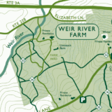
Weir River Farm is by far one of our favorite spots on the South Shore. There is something permanently amazing about a big red barn, farm animals, and old stone walls. If you are debating about whether to become a Trustees of the Reservation member, Weir River Farm should be the tipping point... especially if you have children. The barnyard is your own personal menagerie of animals with sheep, goats, pigs, horses, llamas, chickens, cows, and even a bunny named Joey. In addition to being a place to visit for the afternoon, the Trustees offer many great educational and fun activities onsite. There are children's and teen barnyard programs, BYOB & art viewing events, sheep sheering festivals, and Christmas trees for sale in the winter. Frequently they have meat sales as well that you'll see advertising when driving by the property or on their popular social media sites [ Facebook, Instagram ].

Weir River Farm

Whortleberry Hollow

Easy Hingham Parking

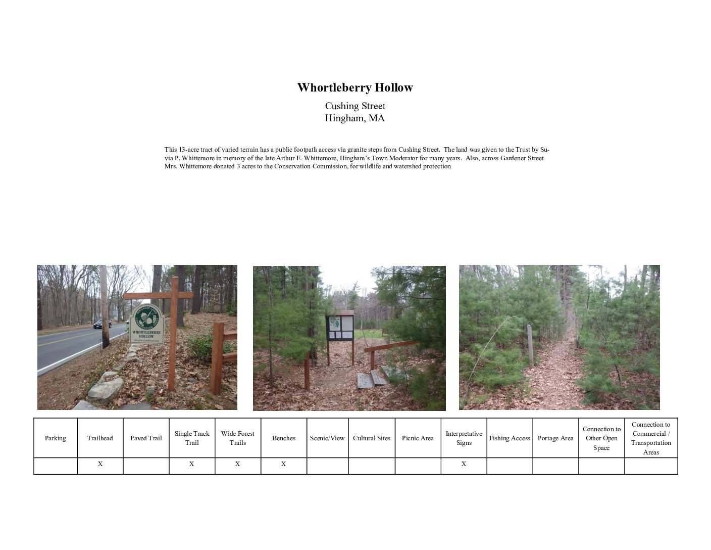
[pdf-embedder url="https://southshoretrails.com/wp-content/uploads/2017/11/Whortleberry-Hollow.pdf" title="Whortleberry Hollow Trail Map"]

Whortleberry Hollow

Wompatuck State Park – Leavitt Street Entrance (Hingham)

Easy Hingham Parking

This alternate entrance to the 3,500+ acre Wompatuck State Park, at the end of Leavitt Street in Hingham, offers access for both pedestrians and cyclists. There is a moderate hill early on the paved trail that could be tricky for some wheelchair and stroller users, but the terrain flattens out beyond that. This particular section of the park was actually one of the more recent additions -- acquired in 2004, it took a full decade to clear the remains of 13 former military buildings before it opened to the public in 2014, thanks in large part to advocacy from Friends of Wompatuck.

Wompatuck State Park – Main Entrance (Hingham)

Moderate Hingham Parking

The main entrance to Wompatuck State Park in Hingham gives access to a genuinely massive property spanning four towns -- Hingham, Cohasset, Scituate, and Norwell -- with over 3,500 acres, 12+ miles of paved bike paths, and more than 40 miles of forest trails for hiking, mountain biking, horseback riding, and cross-country skiing. The land was once home to the Massachusett tribe under Chief Josiah Wompatuck, and later served as a naval ammunition depot from 1941 to 1965, before being converted into a state park. With Aaron River Reservoir on one side and over 250 recorded bird species throughout the park, there is enough here to fill many separate visits.

World’s End

Moderate Hingham Parking

The 244-acre peninsula shares many of the features found on the harbor islands. Overlooking Hingham Bay, it is formed by two drumlins and has rocky beaches, ledges, cliffs, patches of salt marsh and an area of freshwater marsh. From the minute you arrive, it is clear why Worlds End is one of the most popular locations on the South Shore. If you do decide to visit, try to come on the earlier side of the day as the parking lot can get quite full. Feel free to bring your lunch or a snack to enjoy on any of the countless benches that are scattered throughout the property.

World’s End