Cohasset

Landscape

Cohasset is a coastal town about 25 miles south of Boston, bordered by Scituate, Hingham, and Hull. The shore is rocky, with many small ledges and offshore rocks. Cohasset Cove and The Gulf form a long stretch of the Scituate border, while Straits Pond separates Cohasset from Hull. Near the center of the coast lies Little Harbor, a large inlet divided from the ocean by Beach Island. A large portion of the southwestern part of town is occupied by Wompatuck State Park and the Whitney & Thayer Woods Reservation. There are three beaches along the bay, plus the Cohasset Yacht Club, Cohasset Sailing Club, and a public boat launch in Cohasset Harbor. There are 1,970+ acres of conservation land in Cohasset encompassing marshland and forests.

Conservation

The Cohasset Conservation Commission is responsible for the protection and management of Cohasset's conservation land and for the administration of the Massachusetts Wetlands Protection Act and related town bylaws. Conservation land in Cohasset comes from many sources including the town, the Cohasset Conservation Trust, and the Trustees of Reservations.

History

Cohasset was first seen by Europeans in 1614 but not settled until 1670. It was originally part of Hingham, known as Hingham's Second Parish, but separated in 1770. The town's name came from the Algonquian word "Conahasset," meaning "long rocky place." The shipbuilding and fishing industries expanded in the early 1880s. By the early 1900s, wealthy Bostonians began summering here and building large coastal estates, which gradually became year-round homes through the 1930s and 1940s. By the 1950s Cohasset had become increasingly suburban; the 1960 census showed the population had jumped 56% over the prior decade.

Useful Links

Cohasset Conservation Trust - https://cohassetconservationtrust.org Town of Cohasset - https://www.cohassetma.org Cohasset Historical Society - https://www.cohassethistoricalsociety.org Cohasset Chamber of Commerce - https://cohassetchamber.org

Brass Kettle Conservation Area

Moderate Cohasset Parking

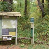
Brass Kettle Conservation trails are located off King Street in Cohasset. The land was officially acquired by the town of Cohasset in 2008 to complete the protection of Lily Pond, a primary town reservoir. The National Heritage and Endangered Species Program identifies the entire property and much of its surroundings area as core habitat for rare species. There are more than 70 species of trees and plants inhabiting this woodland as well as a wide variety of animals and birds including grouse, partridge and deer. These trails create an interesting network that starts at the parking area at the King Street trailhead, west to Wompatuck Park and then north to Whitney-Thayer Woods and Turkey Hill. The historic path, once called Great Lot Lane, linked Hingham and Cohasset and crosses two tributaries of Brass Kettle Brook which are bridged by rock slabs. A side trail leads to paths near Lily Pond. The many stonewalls seen from the path are reminders that the land was once cleared of trees by the grazing of livestock. Several of these walls follow the 18th century parcels of land along east-west property lines that comprised border when the was the town was divided into precincts. (source: Cohasset Conservation Trust ) TRAILS About 7/10 mile to the Brass Kettle Brook crossing. Trails are fairly wide and clear of brush. Trails are relatively maintained but potentially have some trees down depending on your visit timing.

Cohasset Harbor

Cohasset

Cohasset Harbor has a long, rich maritime history -- once a hub for commercial fishing and shipbuilding, it still supports an active lobster fleet today. Five town docks provide public access for boaters and paddlers, two of them (Lawrence Wharf and Parker Ave) with dedicated kayak docks, and the Parker Avenue boat ramp offers a straightforward public launch point. From the harbor, sea kayakers can head out toward Strawberry Point and, conditions permitting, all the way to Minot's Light. The adjoining Gulf River is a different story entirely -- a tidal estuary with fast-moving current over boulders that draws whitewater paddlers during the right stage of the tide, but is genuinely hazardous otherwise. Parking at the boat ramp requires a resident sticker in summer, though loading and unloading is always allowed.

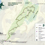
Great Brewster Woods & Dean’s Meadow

Moderate Cohasset Parking

Great Brewster Trail is a hidden gem located right near Cohasset Center. The trail entrance is perhaps a bit concealed which is why I have overlooked the signs for years. The trail is a phenomenal resource and such a great addition to our South Shore trail network.

Great Brewster Woods & Dean’s Meadow

Holly Hill Farm

Cohasset

Holly Hill Farm in Cohasset is a privately owned organic farm that welcomes visitors onto its land and trails, part of a larger 232-acre stretch of protected woodland that also includes the Barnes Wildlife Sanctuary and the Cohasset Boy Scout Retreat. Maps of the farm's hiking trails are available for a small fee on site. It is one piece of a genuinely substantial block of connected open space running from Jerusalem Road to Sohier Street, and from Little Harbor to the western edge of Forest Avenue.

Ingram Park

Moderate Cohasset Parking

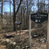
Ingram Park in Cohasset is a trail system on just under 30 acres of historic farm land. The land is protected and managed by the Cohasset Conservation Trust which purchased the most recent 6 acres in 2014. Eagle Scouts from Cohasset Troop 28 have been working on the planned trail system. Depending on the time of your visit, you have a high probability of seeing some wildlife. Due to our winter visit, it was evident that deer are frequent guests and we happened to come across a large family of wild turkeys.

Ingram Park

Pape Reservation

Moderate Cohasset Parking

Pape Reservation is a 10 acre piece of land located off 3A in Cohasset. The conservation area is accessible from the Cohasset Water Treatment Facility parking lot. This is a very basic trail but does include access to Lily Pond and some quiet moments in the woods. Like many Cohasset and South Shore trails, you can expect to see some significant rock formations and stone walls criss-crossing the forest.

Pape Reservation

Sumner Smith Overlook

Cohasset Parking

Sumner Smith Overlook is a very small trail with an incredible view. Located on Cohasset Harbor, the overlook gives you a beautiful view of Cohasset and parts of Scituate. The piece of land is located along Border Street near the Cohasset Sailing Club, town pier, and the Cohasset Lighthouse Keepers house. While there is no true parking assigned to this location, you can often get away with a few minutes either at the town pier or the lot associated with the lighthouse keepers house. There is also some public parking along Border Street which would require a very short walk back to the trail and overlook. The trail itself is located along the big rock and wooded area to the left of the house. While the path is well-maintained, there is often some broken glass so it is best to be careful and always wear sneakers. There are no barriers at the top of the rock ledge - so please be careful! Once at the top of the ledge, you will be granted impressive views of Little Harbor, the bridge, Cohasset Harbor, and the Atlantic Ocean.

Wheelwright Park + Barnes Wildlife Sanctuary

Moderate Cohasset Parking

There is a great network of trails called Wheelright Park that has been built out (and maybe maintained in part) by the Boy Scout troop in that town. When you visit, you'll find a heavily forested area that is teeming with birds and maybe other wildlife too. The park itself is really awesome. While the trails aren't incredibly well marked - they are in general pretty wide and the map is accurate. There was a side trail called the "Lemon Squeezer" that takes you off the main trail by a picturesque stream, old stone walls, and big holly trees. There was some historic fireplace that I passed by - like literally a fire place outside... not a fire pit. The most amazing part? In the middle of the woods there is this incredibly picturesque skating pond! It's like out of a fairy tale. The skating pond was built in the 1935 by the Civilian Conservation Corps during the Great Depression and restored in 2002 by an Eagle Scout project. It is even listed in The Historical Index Survey of Architectural and Historical Assets of the Commonwealth of Massachusetts. Recommendation? Take a picture of the trail map with your phone before starting out. You aren't going to get lost in the woods of Cohasset but this will help.

Whitney & Thayer Woods

Moderate Cohasset Parking

Whitney Thayer Woods is an 824 acre Trustees property located in Cohasset along 3A. The trail network consists of approximately 10 miles of trails through hardwood forests - some of which lead to more forests and others of which lead to incredible views of open fields or the Boston skyline. What makes this property unique are the extensive number of giant boulders left by the prior Ice Age. Some of these are small enough for kids to climb on and others might be 20 feet high. Why visit? Unlike many other trails, this Trustees property has a sizable parking lot suitable for a large group walks or just never worrying about whether you'll find a spot. The property is so vast that you could explore for hours and only see one other person, especially on a week day. The property is linked to several other conservation lands in the area providing limitless opportunities to explore including Wompatuck Park, Whitney Spur Rail Trail, Turkey Hill, and Weir River Farm. TRAILS There are 10 miles of trails that loop through the conservation area. They can vary considerably in terms of accessibility but that old carriage paths are consistent enough for a durable stroller. If you leave that path, you will be likely to find more interesting twisting paths and bridges. The trail map is well marked so be sure to grab one on your way in or download the Trustees app on your phone. Given how connected this site is to others, if you aren't paying attention you could find yourself several miles from your car. POINTS OF INTEREST Milliken Memorial Path, which is lined with rhododendrons, azaleas, and other bright, blooming shrubs from more southerly climes. Planted in the late 1920s, the serene pathway was dedicated in memory of Mabel Minott Milliken by her husband, Arthur N. Milliken. Several glacier formations along the landscape including: Ode’s Den, named after Theodore “Ode” Pritchard, who lived under one of the boulders after losing his home in 1830. Bigelow Boulder honors the author of the first volume of The Narrative History of Cohasset.

Whitney & Thayer Woods

Whitney Spur Rail Trail

Cohasset

The Whitney Spur Rail Trail is a 1.5-mile crushed-stone path connecting the Cohasset MBTA station to Wompatuck State Park, suitable for bicycles and wheelchairs and stroller-friendly along its length. It follows the route of a former railroad spur that once served the Hingham Naval Ammunition Depot -- when the state sold the land for the Cohasset commuter rail station and parking lot back in 2003, the deal included building this rail trail on the old spur as part of the exchange. The lower portion of the trail sits within the Hingham Bay watershed, including the Great Swamp, while the upper section drains toward the Aaron River and eventually Cohasset Harbor. Along the way it passes through forest and wetlands with maple, oak, beech, pine, hemlock, and yellow birch, plus the occasional rocky outcropping and glacial erratic.

Wompatuck State Park – Doane Street/Cohasset Entrance

Moderate Cohasset Parking

The Doane Street entrance in Cohasset provides another way into the sprawling 3,500-acre Wompatuck State Park, which stretches across four towns -- Hingham, Cohasset, Scituate, and Norwell. Doane Street itself has a layered local history: it once connected Cohasset's Beechwood neighborhood, then part of Hingham's second parish, to Hingham's town hall, and the road still traces that old route into the park today.