Plymouth

Beaver Dam Conservation Area

Hard Plymouth Parking

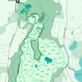
Plymouth's Beaver Dam Conservation Area spans roughly 783 acres, with sweeping views of Little Island Pond and Great Island Pond that draw both anglers and birdwatchers. Much of the property is upland pine barrens, a genuinely rare ecosystem found in only a handful of places -- primarily southeastern Massachusetts, Cape Cod, Long Island, and parts of New Jersey -- making this one of the more ecologically distinctive walks in town.

Billington Street Park

Easy Plymouth Parking

Plymouth's 4-acre Billington Street Park centers on a charming red wooden covered bridge over Town Brook, with a grassy picnic area, interpretive signage, and two rain gardens. The site marks the former location of the Billington Street Dam -- removed in 2002, the first coastal dam removal in Massachusetts, which restored natural fish passage and let migratory herring reach their spawning grounds in Billington Sea after generations of blockage. It connects directly into the 1.5-mile Town Brook Trail: head upstream for Town Brook Patuxet Preserve, or downstream through Holmes Park, Town Brook Park, the Plimoth Grist Mill, and Brewster Gardens all the way to the harbor at Pilgrim Memorial State Park.

Black Cat Preserve

Moderate Plymouth Parking

Plymouth's Black Cat Preserve is a 63-acre woodland with pond views and 2.5 miles of often-challenging trails, plus two reclaimed cranberry bogs slowly returning to their natural state. The Town acquired the land in 2016, consolidating what had been several separately-owned parcels, and a Department of Conservation and Recreation trails grant later funded the removal of old water control structures on the bogs along with two new pedestrian footbridges. Look for the small fishing dock on Briggs Reservoir about half a mile up the trail -- the 17-acre reservoir sits at the heart of the property and feeds into the Billington Sea watershed. Parking can be tricky to find (look near 178 Black Cat Road, not the address most maps show), but the trailhead itself is easy to spot once you're there.

Center Hill Preserve

Moderate Plymouth Parking

Plymouth's Center Hill Preserve is a 98-acre property fronting Cape Cod Bay, split by Center Hill Road into two distinct halves. Center Hill West is thickly wooded upland with narrow, white-blazed trails looping past a town-owned decommissioned cranberry bog that floods seasonally and draws a variety of waterfowl, along with rolling terrain that is a reliable spot for white-tailed deer. Center Hill East adds 28 acres of coastal land with about half a mile of accessible shoreline -- rockier than ideal for swimming, but with genuinely unobstructed views out over the bay.

Clear Pond Conservation Area

Easy Plymouth Parking

The Clear Pond Conservation Area is West Plymouth's only dedicated conservation property, roughly 12 acres of restored cranberry bog with a 0.6-mile circular trail that loops the bog and runs along Clear Pond, with about 150 feet of pond frontage accessible from the trail.

Comassakumkanut Preserve

Moderate Plymouth Parking

The Comassakumkanut Preserve sits near Great Herring Pond in South Plymouth, one of the town's newer publicly accessible properties. A well-worn 0.8-mile trail winds through mixed upland forest before dropping into a genuinely unusual 40-foot-deep valley, where it joins Valley Road -- a historic cart path that once connected all the way to Bourne. The preserve takes its name from the Herring Pond Wampanoag, whose tribal website offers more on the history and meaning behind it.

Crawley Woodlands Preserve

Moderate Plymouth Parking

The Crawley Woodlands Preserve in Plymouth covers about 70 acres off Billington Street, sandwiched between two good fishing ponds: Lout Pond and Billington Sea. Steep rolling hills peak near the center of the property, with glacial erratics scattered throughout, and the main trail can be genuinely strenuous when the ground is damp or frozen -- but it rewards the effort with a lovely sitting area and view of Billington Sea at the far end.

Darby Pond Well Water Protection Land

Moderate Plymouth Parking

Darby Pond Well Water Protection Land and Parting Ways is really two adjoining Open Space parcels in West Plymouth, accessible off Plympton Road near the Kingston line. Parting Ways is a 42-acre area set aside for future cemetery use, but the town has arranged to keep a walking trail open through it to Darby Pond even as that use develops -- from Parting Ways, the route crosses a powerline easement and continues through a former cranberry bog to reach the pond. Watch for the trail markers under the transmission tower where the path picks back up on the far side of the easement.

David E. Alper Nature Preserve

Moderate Plymouth Parking

The David E. Alper Nature Preserve is a long, narrow 19-acre property at the end of Little Herring Pond Road, with nice views of Little Herring Pond along a wide, relatively flat cart path. The local Herring Ponds Watershed Association created and maintains a plant identification walk here, and there is a secluded bench just off the trail if you can find it. Note that the preserve does not provide direct access to the pond itself -- a narrow strip of private land separates town property from the water.

Davis-Douglas Farm

Easy Plymouth Parking

Davis-Douglas Farm, purchased in 2012 through community and public-private funding, serves as Wildlands Trust's Plymouth headquarters and a gateway into the wider Six Ponds conservation area. Trails from the farm connect directly into Emery Preserve West and Six Ponds East Preserve, where the terrain turns hilly with some long, steep stretches, while Emery Preserve East offers cut-in steps and handrails to help visitors up its steepest sections. The local Six Ponds community played a major role in protecting this land -- the Town of Plymouth acquired the connecting parcel between Six Ponds East and Emery West in 2010 with Wildlands' assistance. It is a genuinely community-built network, and it shows in how well the pieces connect.

Dixon Preserve at Hio Hill

Hard Plymouth Parking

Colloquially known as the Hio Hill Preserve, the Dixon Preserve at Hio Hill is a 116-acre Plymouth property backing up to another 73 acres of association-owned open space, offering good habitat for deer and songbirds. The Town acquired the land in 2018, and a new trail was cut and blazed in 2019, ambling through pitch pine barrens past several large glacial erratics on its way to the top of Hio Hill. The loop is short, but the views from the summit are the real draw -- on a clear day you can see as far as Eastham and Wellfleet.

Eel River Preserve

Moderate Plymouth Parking

Eel River Preserve in Plymouth is the product of a genuinely impressive restoration effort by local, state, and federal agencies: 1.5 miles of the Eel River stream channel and 40 acres of cranberry bogs have been returned to a native state, with 17,000 Atlantic White Cedar trees planted that will eventually make this one of the largest Atlantic White Cedar swamps in Massachusetts. A flat, 2-mile perimeter trail begins at the corner of Long Pond Road and Boot Pond Road, crossing wooden bog bridges through the wetter sections, with a smaller loop through older-growth forest at the southern end. A restored pedestrian footbridge -- built where an old dam once stood -- connects Eel River Preserve directly to the neighboring Russell Mill Pond Conservation Area, so it is easy to turn a short visit into a much longer walk.

Ellisville Harbor State Park

Moderate Plymouth Parking

Ellisville Harbor State Park Trail is a trail located in Plymouth, Massachusetts that offers the chance to see wildlife and is good for all skill levels. The trail is primarily used for walking and is dog friendly.

Emery Preserve East

Hard Plymouth Parking

Emery Preserve East is a long, narrow Plymouth property running roughly parallel to Ship Pond Road, with a footpath that crosses a slowly revegetating former gravel pit before climbing into the woods toward Cotton Pond. The trail winds up a hill that is part of the Ellisville Moraine, through pitch pine-scrub oak forest that starts to resemble genuine pine barrens, before descending through gray birch and aspen to the pond itself. Depending on the water level, you may find huckleberry along the shore, or the pond may simply be flooded up into the bushes -- either way, it is a nice quiet destination. The land was donated to Wildlands Trust in 1973 by several members of the Emery family.

Emery Preserve West + Six Ponds East Preserve

Moderate Plymouth Parking

Emery Preserve West and Six Ponds East Preserve, adjoining Wildlands Trust properties in Plymouth, feature generally hilly terrain with some long, steep trail sections, though the ground stays mostly clear of rocks and roots and there are no water crossings to navigate. Both preserves were assembled with strong support from the local Six Ponds community -- Six Ponds East came to Wildlands Trust in 2001, while the connecting parcel between the two was acquired by the Town of Plymouth in 2010 with Wildlands' assistance.

Halfway Pond Conservation Area

Moderate Plymouth Parking

Halfway Pond Conservation Area, a Wildlands Trust property in Plymouth, is often called the eye of Plymouth County, with an extensive network of well-marked trails winding past Big Point, Gallows Pond, and several other connected preserves. The pond supports the Plymouth red-bellied turtle -- an endemic population of the federally endangered northern red-bellied cooter -- along with six mussel species and some of the region's better Bald Eagle viewing. The Stewardship Training Center on site occupies the former estate of cranberry grower LeBaron Russell Barker, acquired by Wildlands Trust in 2022 along with 30 more acres on the pond. Walk for a few minutes or several hours here; the trail network is extensive enough to support either.

Hedges Pond Recreation Area & Preserve

Moderate Plymouth Parking

Hedges Pond Recreation Area and Preserve in Plymouth offers hiking trails through old-growth forest circling the pond, with several spots descending to the water's edge and a main beach with genuinely unrestricted, undeveloped views. The Town's Recreation Department uses the site for day camps and other programming, so access is limited on summer weekdays (closed 8:30 a.m. to 12:30 p.m. from late June through late August), with staffing on weekends from 9 a.m. to 5 p.m. A sticker or parking fee is required during the summer season.

Holmes Reservation

Plymouth Parking

Just outside downtown Plymouth, Holmes Reservation is a 26-acre stretch of open, sloping field managed by The Trustees of Reservations, with sweeping views across the harbor the Pilgrims entered more than four centuries ago. There are no formal trails, just a mowed path around the 0.6-mile perimeter, though you can extend the walk onto the adjacent 1-mile North Plymouth Rail Trail. Before the Revolutionary War, part of this field served as a muster ground, where local militia practiced marching and musket drills -- a history that still gives the place a certain gravity, even on an ordinary walk.

Indian Brook Conservation Area + Manomet Recreation Area

Easy Plymouth Parking

Indian Brook Conservation Area is a sprawling 210-acre Plymouth property with about three-quarters of a mile of frontage along Indian Brook, encompassing the adjacent Manomet Recreation Area, home to four softball/Little League fields and a playground. A recently cleared walking trail runs from the playground, across Indian Brook Road, toward Shallow Pond -- it began life as a deer path rather than a planned route, so it is out-and-back rather than a loop, passing large old-growth pines and centuries-old rain-carved swales along the way. A trailhead kiosk with a trail map, installed in September 2021, sits near the playground in the recreation complex.

Jack Medeiros Memorial Recreation Area

Moderate Plymouth Parking

Jack Medeiros Memorial Recreation Area, formerly known as the West Plymouth Recreation Facility, combines a busy sports complex -- soccer and baseball fields, a modern playground with a rubber surface -- with a network of at least a mile of well-tended, mostly flat forest trails. Look for the simple trailheads along the entrance road and around the edges of the playing fields; they lead through the woods toward a distant view of Grassy West Pond.

Lyman Reserve

Easy Plymouth Parking

Lyman Reserve protects the mouth of Red Brook, a spring-fed, four-and-a-half-mile coastal stream running from White Island Pond to Buttermilk Bay. Red Brook is one of the few Massachusetts coastal streams supporting sea-run (anadromous) fish and holds one of the last native sea-run brook trout fisheries in the eastern U.S. A stretch of shoreline offers views across Buttermilk Bay to the Cape Cod Canal railroad lift bridge.

Morton Park

Moderate Plymouth Parking

Morton Park is Plymouth's largest park, roughly 200 acres of forest and shoreline wrapped around Little Pond (43 acres) and the northern edge of Billington Sea (269 acres), with 4 miles of gravel roads and 2.5 miles of footpaths. Little Pond, a kettle hole, supports non-motorized boating like kayaking and paddleboarding, while the larger Billington Sea accommodates motorized craft too -- both offer swimming beaches and picnic areas, with seasonal restrooms and food concessions. The park dates to 1889, funded by Plymouth citizens and landowners including Dr. LeBaron Russell, under the guidance of Nathaniel Morton, considered the father of the town's park system -- a genuinely early example of public land preservation for its time. Billington Sea itself takes its name from 14-year-old Mayflower passenger Francis Billington, who reportedly spotted the pond from a treetop and, not knowing what he was looking at, believed it might be the Pacific Ocean.

Plymouth Town Forest

Moderate Plymouth Parking

The 317-acre Plymouth Town Forest features four ponds and 2.5 miles of woodland trails, with parking off Long Pond Road. It is one of the larger, more varied trail networks in town, and pairs naturally with a visit to the adjacent 47-acre South Triangle Pond Conservation Area next door.

Rocky Point Preserve

Moderate Plymouth Parking

Plymouth's Rocky Point Preserve packs a lot into a short 0.4-mile trail, winding through forest and freshwater wetlands to a vista atop a high bluff overlooking the ocean. On a clear day you can see Saquish, Duxbury, and even the Outer Cape from the lookout. The town has installed a railing at the viewpoint, but the bluff drops off steeply, so keep dogs leashed and stay well back from the edge -- it is a genuinely dramatic spot, but not one to get too casual around.

Russell & Sawmill Ponds Conservation Area

Moderate Plymouth Parking

Russell and Sawmill Ponds Conservation Area in Plymouth centers on two connected ponds, with trails threading through the surrounding pine barrens and mixed forest. It is one of several Plymouth Division of Natural Resources properties supporting the town's pollinator habitat restoration efforts, with native flowers and grasses planted in open meadow areas along the way.

Russell Mill Pond Conservation Area

Moderate Plymouth Parking

The Russell Mill Pond Conservation Area is a 150-acre Plymouth property along the east side of Russell Mill Pond, with 1.5 miles of trails through upland woods and along the water. It abuts the Eel River Preserve directly, connected by a pedestrian footbridge, so the two properties together offer a genuinely substantial network of trails to explore.

Shifting Lots Preserve

Easy Plymouth Parking

Shifting Lots Preserve in Plymouth sits along Cape Cod Bay, near Ellisville Harbor State Park, with terrain that is generally flat but often loose and sandy -- come prepared with water and sturdy footwear. Long privately owned, the property drew increasing numbers of visitors through the 1990s, many arriving by motor vehicle, until the owners partnered with Wildlands Trust in 2003 to restrict vehicle access and formally establish the preserve. It remains a favorite summer destination for its warm sand, cool water, and classic South Shore views, though seasonal closures protect nesting Piping Plovers and Least Terns, so check current conditions before visiting.

South Triangle Pond Conservation Area

Hard Plymouth Parking

Wildlands Trust's 47-acre South Triangle Pond Conservation Area in Plymouth offers 2 miles of hilly woodland trails with water views, sitting immediately adjacent to the much larger Plymouth Town Forest. The two properties pair well together if you want to turn a shorter visit into a longer day of walking.

Tidmarsh

Plymouth Parking

Its previous owners, the Schulman Family, along with the Massachusetts Division of Ecological Restoration, U.S. Department of Agriculture’s Natural Resources Conservation Service, and many other organizations, re-created nearly three and a half miles of meandering stream channel, sculpted the land’s surface, and removed nine dams to reconnect the headwaters of Beaver Dam Brook to the ocean for the first time in more than a century. The restoration before and after images are absolutely worth checking out! As a result of the collective actions of the collaborators, this entire landscape is now on a dramatic trajectory of change—a spectacle that will play out for decades, and even centuries, to come. (image source: Audubon Society )

Tidmarsh

Town Brook Trail

Easy Plymouth Parking

The Town Brook Trail is a 1.5-mile walking path through the heart of historic Plymouth, running from Billington Street down to the waterfront, linking together Town Brook Patuxet Preserve, Billington Street Park, Holmes Park, Town Brook Park, the Plimoth Grist Mill, Brewster Gardens, and Pilgrim Memorial State Park along the way. The surface alternates between pavement, gravel, and dirt, with several bridges crossing the brook and plenty of spots to pause and take in the view -- it's stroller-friendly from Newfield Street to Water Street. The trail follows the route of the historic Namassakeeset Trail, a pathway the Patuxet Wampanoag established along the brook long before European settlement. Along the way, informational kiosks mark the sites of the First through Fourth Water Privileges, where mills and factories once processed everything from leather and iron to thread and nails. Five dams have since been removed here, the last completed in 2018-2019, and herring counts have rebounded dramatically as a result -- from roughly 7,000 in 2003 to nearly 200,000 by 2016.

Whispering Woods Conservation Area

Moderate Plymouth Parking

Whispering Woods Conservation Area is Plymouth's newest publicly accessible conservation property, a small trail created at the request of nearby residents to give the Herring Ponds neighborhood -- an area somewhat underserved by open space -- a place to walk. The short loop winds through mixed forest with real topographic variety, following ridgelines and dipping into natural hollows, with a small vista near the southern end looking out over a farm in Bourne.