Norwell

Bulman Marine

Norwell Parking

Bulman Marine at King's Landing is a working marina on the North River in Norwell, a practical launch point if you are bringing your own boat or looking to rent one for a day on the water. It sits within an area rich with North River shipbuilding history, alongside sites like the nearby Chittenden Yard and the historic Wanton Shipyard.

Chittenden yard and canoe launch

Norwell Parking

Chittenden Yard and Canoe Launch is a Norwell town landing with a fishing dock and a canoe/kayak launch, situated on a genuinely historic stretch of the North River. A shipyard operated here from 1690 to 1871, producing 71 vessels including the Helen M. Foster, the last ship ever built on the North River -- a bronze plaque marks the site today, and the old saw pit is still visible. The yard's history includes both free Black and enslaved shipwrights, part of the broader North River Early Black Heritage Trail. In 2018 the town made significant improvements to the landing, including the fishing dock, though the launch area itself is rocky and can pose a bit of a challenge for boats.

Cuffee Hill & Black Pond Bog

Moderate Norwell Parking

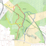
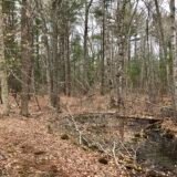
The Cuffee conservation area is a really unique spot near the Norwell and Scituate town lines. Like many area trails, there are some beautiful stone walls the criss-cross the woods. Despite one of the largest conservation areas in Norwell, the site feels largely undisturbed by visitors. Upon my first visit, I was almost frustrated by the lack of trail markings but it turns out they are really just faded and slightly inconsistent. The trails themselves feel safe and well cleared. How did Cuffee get it's name? Well it goes way back. The best description comes from the Norwell Historical Society president - "Cuffee was a slave owned by Joseph Clapp of Mount Blue Street. He married Flora, a former slave of Thomas Clapp, in 1740 in (what is now) First Parish Church in Norwell. Cuffee and Flora had at least three sons to whom they gave the new surname "Grandison."" All three of their sons went on to serve in the Revolutionary War. The land surrounding Cuffee lane was farmed by the Cuffee family for many generations. The most unique feature to Cuffee is the Black Pond Bog - which has an extremely high acidity level. According to the sign onsite, the pond is a deep glacial kettle hole pond. Plants have specifically adapted themselves to grow along the edge of the pond and create a blog of moss, cranberries, leatherleaf, waterwillow.... and orchids. The Black Pond Bog Preserve was purchased in 1962 as the first Nature Conservancy preserve in Massachusetts. There is a large rock marking the dedication to Cap'n Bill Vinal who was a long-time preservation advocate and resident of Norwell. The rest of the trail network at Cuffee is decently marked - but with pretty big wides paths. While we haven't covered the whole network yet, we have checked off the blue, purple, and much of the red trails. There is larger stream that you have to cross if you enter from the Cuffee path entrance. It is not possible with a stroller or toddlers - but just drive to another entrance and you'll be all set. Enjoy your visit to Cuffee!

Cuffee Hill & Black Pond Bog

Donovan-Wildcat Conservation Area

Moderate Norwell Parking

The Donovan-Wildcat Conservation Area is rich with history. The conservation area is a 50-acre site that was part of a 1997 land acquisition by the town of Norwell. The conservation land consists of fields and some wooded areas as well. The Donovan fields were originally known as "White Oak Plans" and was part of a large Colonial land grant to the Clap family. It was cleared for farming in 1820. A horse track was also established where Centennial Way is now located. By 1955, there was a thriving and successful apple orchard which is now long gone. The only evidence of this orchard is a low brick building that was used for storage and packing. The construction of the trail was part of a development agreement in 1997. As the trail progresses, it transitions to the Wildcat Hill area. This was an area that was originally settled by freed slaves from the Clap family. There are incredible stone walls that criss-cross through the forest. TRAILS There are two main entrances to the trail with parking access. Additionally, the trail can be divided into two sections: field and woods. FIELD - If you access via Pleasant St, the trail travels along the west side of the field to an old pond area with the remains of a stone dam. You can walk around the field the the Norwell Walkway. This trail is more level and stroller accessible. WOODS - Just under 2 miles of trails in the woods. Terrain is very uneven and rocky. Not as well maintained but largely the paths are clear. Depending on the time of year, it might be easier to see the trail markers.

Fogg Forest and Carleton Property

Easy Norwell Parking

Fogg Forest is a 40 acre piece of land located off Rt 123 in Norwell. The conservation area is very accessible even if the parking is a bit confusing. While we visited during the early Spring, this trail is absolutely worth a visit when the flowers are blooming. Some of the trails are lined with rhododendrons, which would look really amazing. Like many other trails in the area, this forest is rich with stone walls that used to designate property lines and farm fields. The most unique part of this property is an enchanting wooden garden that was built around a stream. You'll feel like you traveled back in time.

Fogg Forest and Carleton Property

Hatch Lots Conservation Area

Easy Norwell Parking

Hatch Lots is a great walk for families looking to spend 45 minutes in the woods. The conservation area is just under 50 acres with about 2 miles of trails. It's an out and back trail so there is no loop. There trails are well maintained and include a few small bridges. You'll appreciate them not only for photo opportunities but also to keep your feet/paws out of the mud. Much of the preserve is swamp land. If you are interested in staying away from mud, avoid visiting after a rainy day. But perhaps the best part about a visit to Hatch lots is being able to visit Hornstra Farms! Part of the trail system at Hatch abuts Hornstra Farms fields - but to visit you need to drive just around the corner. At Hornstra Farms, you can get up close with adorable young baby cows and pick up some locally made products. Hornstra sells their own tasty ice cream and other dairy related products - but they also have breads, cookies, donuts etc.

Jacobs Pond Conservation Area

Easy Norwell Parking

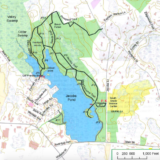
The Jacobs Pond conservation area consists of about 260 acres of land in Norwell. The pond itself consists of about 60 acres of man-made pond and 200 acres of land.The Jacobs Farm (house, barn, hayfields) are owned and protected by the town of Norwell. The pond is incredibly picturesque - especially for an autumn visit. You may even get lucky enough to see a few turtles peek out and say hello. The original pond was named Snapper Pond which in local Native American translated to "rocky water". Some rocks are easily visible from the shore. Why visit? Well, you can do just about everything here that isn't motorized. Fishing, kayaking, cross-country skiing, and all ice related activities (fishing, boating, skating) are permitted. The network of trails lends itself to good walks and bird watching. Additionally, there is plenty of parking which makes it an ideal place for friends to meet up and enjoy the great outdoors! TRAILS Perhaps 2 to 2.5 miles of trails along the pond and through the forest. Trails are flat but not improved beyond removing brush or big rocks. There are lots of roots the protrude from the surface. The trails lead through forest predominantly with great views of the pond. HISTORY The Jacobs Pond was created in 1730 with the addition of the Third Herring Brook dam. The pond was called Snapper Pond. Energy from the dam was used to run the mills. The gristmill was abandoned and the sawmill burned in 102-. Additionally, there was a brick manufacturing facility from 1680 to 1830. ( source Norwell map detail )

Jacobs Pond Conservation Area

Masthead Drive Trail

Easy Norwell Parking

Follow Norwell's Masthead Drive all the way to its end and park in the cul-de-sac; the trailhead is just behind the storm drain grate. From there, the trail winds through the woods, up and down some moderate rolling hills, and across a small footbridge -- after about 0.4 miles you'll find yourself looking out over the North River, a genuinely gorgeous spot, and if you continue a bit farther to the left there are two additional vantage points worth the extra steps.

Miller Woods

Easy Norwell Parking

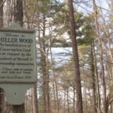
Miller Woods is a 46 acre piece of undeveloped land located near Norwell town center. The trail network consists of a great picnic area that is perfect for a couple of friends - or a large family. Miller Woods is great year-round but is perfect in the summer heat as the heavy wooded area will provide some relief from the heat. Miller Woods has remained unchanged for over 150 years.

Miller Woods

Norris Reservation

Easy Norwell Parking

Norris Reservation is one of the most popular trails on the South Shore. The parking lot is consistently full nearly every weekend day - and frequently on week days as well. Why are all these visitors flocking to Norris? Because it is right at the sweet spot for being approachable and interesting. Norris Reservation is ideal for a solo walk with a podcast, two friends looking to catch-up, or a family getting some fresh air after work. Norris covers 129 acres near Norwell center - but the gentle nesting of trails provides enough options for every one who visits. Even with a full parking lot, you can have the trail to yourself for a good stretch of time. By following the trail map, a visitor can sketch out a quick 30 minute walk to North River or a slightly longer 60+ minute walk that includes a pond and some large trees. The Trustees of the Reservation website suggests that there are two miles of trails in total. For parents and little ones? Nearly the entire trail network is perfectly suitable for a durable stroller or kids walking. There are some slightly steeper points but it is one of the most stroller friendly trails that does not include boardwalks or pavement. The trails are very well-maintained and clean - despite the heavy usage. Dog owners are generally responsible and it's rare to see any trash on the trails. Occasionally, I'll find a coffee cup but I can say with some certainty it was left there by accident. Few people would leave behind a half-filled Dunkin Donuts coffee on a tree stump. A little bit of history? The land along the North River was known as a major center of New England maritime history. Timber used for shipbuilding was harvested from what is now known as Norris Reservation. In addition, the pond and dam on the property once helped power the mills onsite. While wandering the woods, you'll also see countless stone walls criss-crossing the landscape. The stone walls had dual purposes: property lines and keeping pasture and crop land separate. Special spots? There is a great picnic table right near the entrance by the babbling stream. It's perfect for some friends to meet up for lunch. The Boating Hut on the river. Provides a great place to take a little rest and enjoy the view. It is picturesque all year long. The Pond and Herring Brook are great for little ones to look for turtles and fish up close - or toss a few tiny rocks to make some splashes. Countless benches scatter the trails along the North River. If the fishing hut is busy, just keep walking and you'll find a nice place to rest.

Norris Reservation

Norwell Town Landing

Norwell Parking

The Norwell Town Landing sits on the North River at Bridge Street, right at the Union Street Bridge, with a boat ramp reserved for Norwell residents (non-residents can launch across the river at the Marshfield side). This is also the starting line for NSRWA's annual Great River Race each year. The site has a fun bit of history: from 1893 until the devastating 1898 Portland Gale, the North River Boat Club stood right next to this landing, hosting races, dances, and dinners throughout the year. At dead low tide, look upstream on the Norwell bank for the barely-visible remains of an old North River ferry boat -- water access only, but a neat find if you time it right.

Simon Hill and Bowker Street Conservation Area

Easy Norwell Parking

As its name suggests, the terrain at Simon Hill and Bowker Street Conservation Area is hilly, and rocky in places, with an interesting footbridge built from a single large split log. Simon Hill is named for Simon, a member of the Mattakeeset tribe who lived here in the late 1700s, while the Bowker Street portion is maintained by the Town of Norwell for reserve drinking water wells and groundwater protection as well as passive recreation. In 2020, a connector trail made of bog boards was constructed through the wetlands at the edge of Burnt Plain Swamp, linking Simon Hill directly to the adjacent Hatch Lots Conservation Area -- worth the extra distance if you want to turn a short walk into a longer loop.

Stetson Meadows

Norwell Parking

Stetson Meadows is a 184 acre conservation parcel in Norwell located along the North River. The area has a rich history dating back to 1634. Stetson Meadows is one of the more quite trails in Norwell - despite being located very near 3A. You'll have the opportunity to walk through the forest, along the marsh, and run through a field. So pack a snack, some binoculars for birdwatching... and hit the trail.

Stetson Meadows

Valley Swamp Conservation Area

Moderate Norwell Parking

Norwell's Valley Swamp Conservation Area offers about 1.3 miles of woodland trails with views of freshwater swamps, including some of the headwaters for Third Herring Brook. There are two distinct sections to the property, giving a bit of variety within a relatively modest total distance.

Wompatuck State Park – Grove Street Entrance (Norwell)

Easy Norwell Parking

The Grove Street entrance is the newest access point into Wompatuck State Park, located diagonally across the street from the Hornstra Farm sign. It is a convenient way into this 3,500-acre state park from the Norwell side, with the same 12 miles of paved bike paths and 40+ miles of off-road trails available from any of the park's other entrances.

Wompatuck State Park – Mt. Blue Street Entrance (Norwell)

Moderate Norwell Parking

The Mt. Blue Street entrance in Norwell is one of many access points into the sprawling, 3,500+ acre Wompatuck State Park, which spans four towns -- Hingham, Cohasset, Scituate, and Norwell. Inside, there are 12+ miles of paved bike paths and over 40 miles of forest trails for hiking, mountain biking, horseback riding, and cross-country skiing, so this entrance is a good starting point if you are coming from the Norwell side and want to avoid the more crowded main entrance in Hingham.