Hiking & Paddling Trails on the South Shore of Massachusetts

309 trails, parks, and paddle launches across 27 towns — free and community-built since 2017.

Explore by Town

All 27 towns →

Popular Trails This Month

View all trails →

Eight Ponds Pass

Moderate Plymouth Dog friendly Parking

Eight Ponds Pass is an ambitious yellow-blazed through-trail, envisioned to eventually run nearly 9 miles across Town conservation land, private parcels, Wildlands Trust property, and into Myles Standish State Forest, linking together eight ponds along the way. The Town's 2026 trail guide covers the completed eastern segment, roughly 4-5 miles from Beaver Dam Conservation Area to the Wildlands Trust headquarters on Long Pond Road, passing Little Island Pond, Great Island Pond, and Cotton Pond, crossing through Wildlands Trust's Emery East Preserve, and climbing a notably steep, rope-assisted hill near a former sand pit. This is a linear route, not a loop, so plan to stage a car at each end -- and pay close attention to the yellow blazes, since there are stretches on public roads and several spots where it's easy to wander off course.

Kapell Pinnacle Preserve

Easy Plymouth Dog friendly Parking

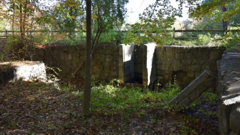
Named for its donor and for nearby Pinnacle Hill, Kapell Pinnacle Preserve is one of the Town's newest cranberry-bog restorations: the Department of Energy & Environment acquired roughly 51 acres here, about 15 of them former cranberry bog, taken out of agricultural production through the USDA's Wetlands Reserve Program. A $740,000 state Division of Ecological Restoration grant is funding the construction work -- removing old water gates, dikes, and channels to let the land return to a natural, wetter kettle-bog state, with new seeding, plantings, and a trail system planned. The property sits within the Zone II wellhead protection area for the Town's South Pond wells and abuts the federally designated Great Thicket area, land set aside for shrubland and young-forest wildlife habitat. Once complete, a wide, flat, grassy trail will circle the bogs with an in-and-out spur into a mature white pine forest.

Foothills Preserve

Moderate Plymouth Dog friendly Parking

Completed in spring 2021, Foothills Preserve is a 126-acre former cranberry bog directly across from Mass Audubon's Tidmarsh Wildlife Sanctuary, restored by tearing out the old bog infrastructure and letting the newly named Manomet Brook wind naturally through the wetland again. The wide, flat, hard-packed sand loop circles the restored bog and is genuinely one of the more accessible trails in town -- easy going for bikes, wheelchairs, strollers, and dogs alike, with foot bridges over the brook and open sightlines that make for excellent sunrise and sunset views. Look for a grove of large old cedars near the northern end, and a partial whale skeleton on display near the Dept. of Energy and Environment storage barn in the southeast corner, left to bleach in the sun after washing up on a Plymouth beach some years back.

Keville Footbridge & Pratt Trails

Marshfield

The combination of the Bridle Rail trail and Pratt provides visitors a 2 mile walk with many unique features. I can imagine this being an ideal for families since the terrain is largely very flat but with many things to keep little kids entertained. The Bridle Trail is actually many miles long as it stretches through Marshfield so this is only a very small piece of it. The Pratt trails are built around the Zena Brook, which flows through the 37-acre Pratt property. In 2017, many of these footbridges were restored to increase accessibility to the area. Residents voted to acquire the Pratt property at special Town Meeting in 2012. Additional plans are in place for the Pratt property itself which includes a beautiful but decaying home.

Find Your Kind of Outing

What’s Good Right Now

Best Trails for July on the South Shore

Shaded woods, breezy coastal walks, and paddle-friendly water for the hottest weeks of summer.

Latest Guides

All guides →

About South Shore Trails

South Shore Trails is a free, community-built guide to hiking, walking, and paddling on the South Shore of Massachusetts. Since 2017 we’ve cataloged more than 309 conservation areas, town forests, beaches, rail trails, and boat launches across 27 towns from Quincy to Plymouth.

Every trail page includes directions, an official trail map, and honest notes on what to expect — whether you’re looking for an easy walk near home, a kid-friendly loop for the weekend, or a quiet put-in for your kayak.

Trail data comes from town conservation departments, the NSRWA, Wildlands Trust, The Trustees, and our own boots on the ground.

Common Questions

What towns does South Shore Trails cover?

27 towns across the South Shore of Massachusetts, from Quincy and Braintree down to Plymouth and out to Rochester.

Are the trails free to visit?

Nearly all are free public conservation land. Any exceptions are noted on the trail page.

Which trails are good for kids or strollers?

See our kid-friendly and accessible trail collections for flat, short options.

Where can I find official trail maps?

Every trail page links to the official PDF map from the town or land trust that manages the property.