 South Shore Trails
Trail Map
309 trails, parks, and paddle launches across 27 South Shore towns
Click any pin to open the full listing — parking info, a downloadable trail map, directions, and notes on what to expect.
Popular Trails
-
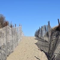 Rexhame Beach Trail
Marshfield ·
Updated Sep 5, 2026
Rexhame Beach Trail
Marshfield ·
Updated Sep 5, 2026
- Holmes Reservation Plymouth · Updated Aug 28, 2026
- Stone Farm Conservation Area Brockton · Updated Aug 28, 2026
- Wyman North Fork Conservation Area Bridgewater · Updated Aug 28, 2026
- Eight Ponds Pass Plymouth · Updated Aug 28, 2026
- Rocky Point Preserve Plymouth · Updated Aug 28, 2026
- Halfway Pond Conservation Area Plymouth · Updated Aug 28, 2026
- Bates Lane Conservation Area Scituate · Updated Aug 28, 2026
- South Shore Natural Science Center Norwell · Updated Aug 28, 2026
- Sydney Ice Pond Hingham · Updated Aug 28, 2026
Frequently Asked Questions
Are these trails free to visit?
Nearly all of the destinations in our directory are free, publicly accessible conservation land. A small number charge a fee — World’s End in Hingham ($8–$15 per vehicle for non-members) and some DCR state parks that charge for beach or boat ramp access in summer. Any cost is noted on the individual trail page.
Are dogs allowed on South Shore trails?
Many trails welcome dogs, but policies vary by property and managing organization. Some require dogs to be leashed at all times; a few have designated off-leash areas; and some conservation areas prohibit dogs entirely. Check the individual trail page before you go — we note dog policy for every listing. You can also filter the trail directory by dog-friendliness.
Which trails are accessible or stroller-friendly?
A number of trails on the South Shore are paved or have flat, wide surfaces suitable for strollers and wheelchairs. See our Accessible & ADA Trails guide for a curated list. On individual trail pages, look for the ADA access field in the trail details table.
Can I kayak or canoe at these locations?
Yes — the South Shore has dozens of ponds, rivers, and coastal areas with public launch points. Our Paddle page lists all 83 paddle-friendly destinations, filterable by water type (river, pond, beach, or marsh) and town.
How current is the map?
We update the directory regularly as new trails open and conditions change. If you notice something out of date — a closed trail, a wrong address, a missing location — use the Report Issue link in the site footer and we’ll look into it.
What’s the difference between this map and AllTrails?
AllTrails is a national app with user-generated content. South Shore Trails is a locally maintained, free directory focused exclusively on the South Shore of Massachusetts. We include smaller conservation areas, town-owned parcels, paddle launches, and beach access points that often don’t appear on AllTrails, and every listing links to the official trail map from the managing organization rather than a crowd-sourced route.