Scituate

AJ Mceachern Memorial Trail

Scituate

AJ McEachern Memorial Trail is a wonderful spot located on the marsh in Scituate. It is perfect for all ages and offers some of the most beautiful and unique views of Scituate's Landscape. This particular spot is most popular with dog owners, kayakers, and photographers. The parking lot provides the perfect place to launch kayaks on the North River. Even if you aren't interested in a walk, the piers and benches provide a great place to just watch the sunset or enjoy your coffee. You can see Scituate's history through old pier pilings that protrude from the water.

AJ Mceachern Memorial Trail

Bates Lane Conservation Area

Moderate Scituate Parking

The Bates Lane network of trails is a hidden treasure in Scituate. I'm embarrassed that I did not know it existed until recently. Each of the 6 trails is unique and worth the time spent on them! What you should know: This was my first time visiting the Bates Lane trails. I find many of my trails by seeing the parking lots as I'm driving by - there is no real parking lot for these trails which is why I never found them before. I think the best place to park is at the Mt Hope Church. This provides for a great entry via the Litchfield Trail. If you happen to find parking near Bates Lane that would also be great. I spent 3 miles exploring all these trails and found them all to be a bit different - so I'll try to call out some of the differences below. After looking at the map, I had my heart set on getting to the brook at the end of the properties. It was absolutely worth it. There were so many great moments along the way too. So many stone walls criss-crossing the forest accompanied with gigantic tall trees. In all of that natural beauty, the trails are incredibly well maintained and marked. There is usually a moment in every trail where you are not quite sure where you are - that will not happen. I think nearly every map has a "you are here" spot - and there are maps at nearly all the intersections. Litchfield Trail - Primary entry point. Largely even terrain but some sections have big tree roots and medium sized rocks in the path. Horse Trail - More narrow path - but with a lot of smaller trees close by. Feels like a hidden wonderland. Bates Lane - Big wide path. Perfect for strollers and groups of friends. Maxwell Trail - Definitely not feasible for strollers - but absolutely worth the work. It's not a very challenging trail just narrow and uneven at times. Incredibly picturesque as you get closer and closer to the brook. Carl Pipes Trail - Largely very even and approachable.

Crosbie Family Preserve & Appleton Field

Moderate Scituate Parking

Scituate's Crosbie Family Preserve and Appleton Field are adjacent properties with several intersecting loop trails through 49 acres of fields, woodlands, and wetlands, dotted with numerous old stone walls. The preserve sits on a glacial drumlin with Appleton Field at its center and South Swamp wrapping around it -- keep an eye out for the unusual Atlantic white cedar along the orange trail, at the edge of the swamp. It is one of several connected properties in Scituate's West End, alongside the Bates Lane Conservation Area, the Higgins-MacAllister Preserve, and the Damon Preserve.

Cushing Memorial State Park

Easy Scituate Parking

The 4.8-acre Cushing Memorial State Park in Scituate features a short woodland trail leading to the burial site of US Supreme Court Chief Justice William Cushing, regarded by many as Scituate's greatest citizen. A second short trail heads down a forested hillside to a bench overlooking the salt marsh -- a quiet, contemplative spot rather than a destination for a long hike.

Damon Preserve

Moderate Scituate Parking

The 37-acre Damon Preserve in Scituate features 1.2 miles of woodland trails, numerous stone walls, and glimpses of open fields, plus occasional glacial erratics, situated on the side of a drumlin hill at the edge of South Swamp. Opened to the public in 2022 and purchased with Community Preservation funds through the Maxwell Land Trust, the land was assembled by Roger Damon in memory of his grandson David William Damon -- a formerly private tree farm turned into a genuinely pleasant public walk.

Driftway Conservation Park

Easy Scituate Parking

Driftway Conservation Park is 334 acres of Scituate Conservation land with a panoramic view of the Herring River and its salt marshes. In the 1930s, Boston Sand and Gravel owned this property and mined it for projects like the construction of Logan International Airport -- you can still see vestiges of the wharf built to transport sand via barge to Boston. Today it offers walking trails, a fishing pier, a small boat launching ramp, an open field, and picnic benches, plus a great vantage point at Lookout Hill, the highest point in the park, with panoramic views of Third and Fourth Cliffs and the mouth of the North River.

Ellis Estate Trails

Moderate Scituate Parking

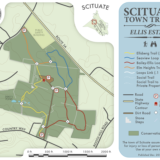
Scituate's 89-acre Ellis Estate features an extensive trail network through the woodlands surrounding the historic Bailey-Ellis House and Deke's Pond. Built in 1830 by John Wade Bailey and originally named Elm Heights, the house was later renamed for his descendants, the Ellis family, and today serves as the headquarters of the Scituate Arts Association -- it has also appeared as a filming location for at least two horror movies. There are about 2 miles of well-marked, intersecting trails here, and if you look closely near Trail Junction #2, you'll spot two old stone walls set curiously close together, likely built to funnel cattle toward a nearby spring.

Ellis Estate Trails

Gannett Road

Scituate Parking

Gannett Road in Scituate is a paved path connecting the town's neighborhoods, narrow enough (about 5 feet wide) that it functions more like a sidewalk than a proper shared-use bike path -- walkers and runners can use it comfortably, but cyclists should proceed at a modest pace given the tight width and the number of driveways crossing it. It also provides access to the Musquashicut Brook Launch, a spot for putting a canoe or kayak into the lower reaches of Musquashicut Brook and the Gulf River.

Higgins-MacAllister Preserve

Moderate Scituate Parking

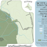
The Higgins-MacAllister Preserve in Scituate features a 1.2-mile loop trail, crossing a large wooden bridge and then winding through woods and wetlands with views of Merritt Brook, a tributary to Bound Brook. There are a lot of rocks here -- glacial erratic boulders, moss-covered stones, and numerous old stone walls -- and the preserve connects directly to the adjacent Bates Lane Conservation Area if you want to extend the walk. While in the neighborhood, the Damon Preserve and the Crosbie Family Preserve/Appleton Field are both close by too.

Higgins-MacAllister Preserve

Hubbell Preserve

Moderate Scituate Parking

The Hubbell Trail is located on about 40 acres of land in the North Scituate area of Scituate. While this area is well known for marsh and ocean views, the wooded landscape of the Hubbell preserve is a fresh perspective. The trail is relatively new as compared to other South Shore trails. The Hubbell preserve was initially started in the 1960s with a donation by Dick Hubbell and continued in recent years with an additional 16 acres. In 2016, the initial trail work was initiated by XX as part of an Eagle Scout project. Eagle Scout projects are a great way to enhance the utilization of town resources. The nearby Minot Beach Kayak ramp is another great example. The trail provides a great resource for the Minot and North Scituate neighborhood. There is no official parking lot but visitors can park along Indian Trail right at the trailhead. The trail is not suitable for strollers and young children should be very cautious on rocky trail and granite ledges. Don't forget to enjoy the log cabin style benches along the trail... they might be the best part! TRAILS There is one main trail in the Hubbell preserve but with three colors of trail markers. The primary trail starts on Indian Trail and works its way into the forest. The trail is wide but with uneven, rocky terrain. Additionally, it is quite rocky with granite boulders being incredibly prevalent. Trail markers: white - main trail yellow - small loop off the main trail blue - 2nd portion of the main trail

Minot Kayak Ramp

Scituate

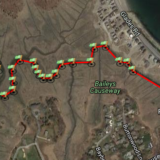
The Minot Kayak Ramp is a great access point for those looking to explore the North Scituate marshes, Bassing Beach or Cohasset Harbor area. The ramp was formally constructed as part of an Eagle Scout project in 2015-2016 by a Scituate resident. The project went through the formal town processes and has been an incredibly popular kayak ramp ever since. You are almost guaranteed to see another person out of the marsh during your visit - but don't worry, it's not too crowded. In the map below, we've highlighted a route that will take you to Cohasset's Bassing Beach. All you have to do is follow the main path of the marsh and you'll make it there in just over 1 mile. Bassing Beach is a beautifully quiet spot to take a rest before turning around - or continuing your adventure. Maybe you are even smart enough to pack a picnic lunch. Important Information: Check out the informational sign! There is a great nautical map of the area that will help you understand water depth and different marsh passages. Friendly hint? One side of the sign is the map, the other side covers wildlife that you could expect to see. Always practice good judgement and wear a life jacket. Safety is really important, so please be prepared.

Minot Kayak Ramp

Old Rail Bed

Scituate

One of the most picturesque trails in Scituate is the smallest. The old rail trail can be found along the marsh in Scituate's Driftway area. The Driftway area of Scituate includes some beautiful marsh views. Despite being located near a busy road, you'll feel like you were transported to a place far more remote. The AJ Memorial trail is another great option located just down the road. If you only have 15 minutes and just need some fresh air, this rail trail is perfect for you. Enjoy your time on this historically relevant town trail! Trail Details: The trail is just under 1/2 mile long and runs from the small parking lot into the marsh and North River. The environment is perfectly suited for families with little kids to stretch their legs or even strollers. Since this is a town trail, pets are also welcome provided they are on a leash. It will be obviously when you've reached the end of the passable trail but you'll be able to see very clearly where the trail used to travel. At a low tide, it could be tempting to try and cross the marsh river but it is not advisable given deep marsh mud and the quick turnaround on the tide.

Scituate Harbor (Big parking lot)

Scituate Parking

Scituate Harbor's main parking lot on Cole Parkway is the primary access point to the half-mile Scituate Harborwalk, a concrete walkway with a guardrail that overlooks Satuit Brook and the harbor, passing the Harbormaster headquarters, several marinas, and the Morrill Memorial Bandstand gazebo along the way. With more than 200 vehicle spaces, this is the easiest lot to use if you are planning to spend real time exploring the harbor on foot.

Scituate Harbor (Jericho Road)

Scituate Parking

The Jericho Road entrance to Scituate Harbor picks up the Harborwalk near its far end, where the concrete path continues past the Scituate Town Pier and the Bates House before reaching the Scituate Harbor Community Building. It is a good alternative starting point if the main Cole Parkway lot is full, or if you would rather begin your walk from this quieter end of the harbor.

Scituate Harbor (Lighthouse)

Scituate Parking

Scituate Lighthouse, also known as Old Scituate Light, is an iconic and beloved landmark welcoming mariners into Scituate Harbor. Built around 1811, it was the eleventh lighthouse constructed in the country, and it remains one of the more photogenic stops on the South Shore, worth the visit for the view alone even if you are not planning a longer walk.

Scituate Town Forest

Easy Scituate Parking

The Scituate Town Forest is an 18-acre pine forest on Route 3A in North Scituate, offering more than a mile of trails via a loop off two metal gate trailheads, directly across from the town's police headquarters. It is a small, straightforward woodland walk -- nothing fancy, but a nice quiet break if you are already in the area.

Teak Sherman Memorial Park & Community Garden

Easy Scituate Parking

Scituate's Teak Sherman Memorial Park and Community Garden is a small park with old stone walls and a 0.12-mile trail through the woods, connecting the parking area on Route 3A to the town's community garden plots. It is a quiet, low-key spot rather than a destination hike, but a nice quick stop if you are in the area.

The Spit

Scituate

The boardwalk to the Spit is one of the most photographed views in Scituate after the Lighthouse - or that is what social media would lead us to think. The walk out to the beach from Third Cliff is fairly short but incredibly beautiful. Regardless of the weather or season, the marsh and boardwalk are very picturesque. While we think this spot is beautiful all year long, you'll find the Spit Boardwalk most picturesque during the golden photography hours (before mid-morning or late afternoon). Additionally, parts of the boardwalk might be flooded depending on the tide. Caution: There is no legal parking option located directly near the trail entrance. The closest public town parking option is about 1.4 miles away at the AJ Memorial Trail. Trail Details: The boardwalk/trail is under 1/2 mile long and runs from the road down an unpaved path between two houses. There are a few steps down from the dirt path to the boardwalk. The boardwalk is generally in great condition and crosses a few streams that run through the marsh. At the end of the boardwalk, the path transitions to the beach!

Widows Walk Golf Course (seasonal)

Scituate Parking

Widow's Walk is one of the most popular walking areas in the town of Scituate. Visitors can't wait for golfing season to be over to explore the property. The site is most frequently visited by walkers with dogs. The large property is also well known with bird watchers. Visitors frequently post to town social media about various wildlife sightings like coyote, fox, and different birds of prey. As a commitment to the environment Widow’s Walk became a Certified Audubon Cooperative Sanctuary course in 2002. This program ensures a commitment to the environment by establishing avian nesting box programs, providing habitats for numerous other species of animals, and using integrated pest management to apply the least amount of water, pesticides and fertilizer as possible. ( source ) Visitor Reminders: follow town leash laws. keep dogs on a leash at all times. pick up dog waste Property History Built on the site of an abandoned 100-acre gravel quarry formerly owned and operated by the Boston Sand & Gravel Company, the landscape had been altered and scared by many years of gravel mining—which provided among its many destinations the gravel used in the construction of both the Southeast Expressway and the runway expansion at Logan International Airport. The excavation of sand and gravel here over the years was so great, in fact, that Scituate, Massachusetts, was once ranked as the #1 port of export in the world, based on tonage. The "pits" as it was known, presented the Town of Scituate with a unique opportunity to transform this ecologically impoverished eyesore and public nuisance into an aesthetically pleasing, 18-hold public golf course, while maintaining and protecting its uncommon habitat and wildlife. ( source )